The historicity and nativity of Tapassu and Bhallika, the two merchant brothers of Utkala who became the first disciples of Lord Buddha, are shrouded in mystery. Utkal was a very ancient country. In Buddhist literature it is described as ‘Ukkala’ or ‘Okkala’. In the Brahminical literature we find copious depiction of Utkala, said to have been located in the southern region of extended Vindyan range along with Mekalas, Kalingas, Andhras and others. Most scholars are of the opinion that Utkala of the epics and Puranas is the same as ‘Ukkala’ or ‘Okkala’ of the Pali literature.
According to Majjhima Nikaya, Vassa and Bhanna are the two tribes of Ukkala who professed a type of religion called Ahetuvada, Akiriyavada and Natthikavada. These two tribes later on are known to have embraced Buddhism preached by Lord Buddha. Under this historical backdrop, we have to identify the original homeland of Tapassu and Bhallika basing on the fresh archaeological evidence. Now, the Department of Culture, Govt. of Orissa is making extensive archaeological exploration and excavations in various parts of the state to gather scientific source material to strengthen the historicity and nativity of the two famous merchant brothers of world eminence.
Literary Record:
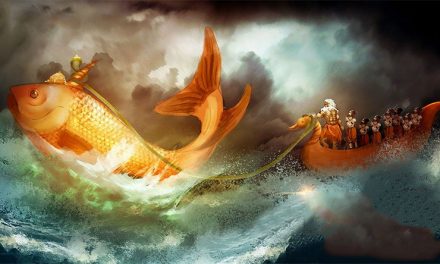
According to early Vinaya texts and the Anguttara Nikaya, “two merchants named Trapusa (Pali Tapassu or Tapussa) and Bhallika (Pali Bhalliya) approached the Buddha eight weeks after his enlightenment and offered rice cakes and honey”. The present-day Buddhist community residing in the Athagarh-Baramba region of Cuttack District and Kantilo-Padmavati-Banki, opine that the merchants offered the Lord ‘Arisa Pitha’ (rice cake mixed with ghee and molasses) in a bowl provided by the four guardians of the directions (Lokapalas). After offering these gifts, Tapassu and Bhallika became the first lay disciples (Upasaakas) and received relics of Buddha’s hair (eight handful strings of hair) and nails which the Tathagata offered them to enshrine in stupas in their home country.
The merchant brothers carried home the divine relics to their native city Asitanjana where they deposited it in a magnificent Chaitya, erected for the purpose. According to the commentary of the Theragatha, these two merchants also subsequently visited the Buddha at Rajagriha and by that time Tapassu was renamed as Sotapanna and Devachikaupasaka, and his name has been incorporated in the list of eminent upasakas of Lord Buddha. Bhallika, on the other hand, joined the Sangha and became an arhat. The Pujavaliya text of Ceylon delineates that Tapassu and Bhallika after their conversion visited the east coast of Sri Lanka, where they erected a Chaitya to commemorate their visit.
The site where the merchant brothers reached in Ceylon might be identified with Manthai harbour city, with which the ancient Oriya people had tremendous maritime contact. The archaeological material of Radhanagara has a striking similarity with the material found at Manthai harbour in Sri Lanka i.e. Fine Grey Ware and Black Slipped Ware, Knobbed Bowls, or Begging Bowls etc. Radhanagar (spelt as Rajnagar in 1929 Toposheet) is situated in Jajpur district of Central Orissa.
The Recent Explorations and Excavations:
Several Buddhist remains within a particular geographical limit with Radhanagar Fort as the epicenter have been found at places like Kayama, Deuli, Tarapur, Vajragiri, Langudi, Kantigadia, Neulpur, Panturi, Bandareswar, etc. These sites are covered under limited excavation to trace their cultural sequence. Even in the trial and experimental explorations, inscriptions mentioning the names of Tapassu and Bhallika at Tarapur and Deuli have been located. The inscriptions have been deciphered by J. Jayprakash, Epigraphist, Archaeological Survey of India.
The survey also resulted in the discovery of at least 10 massive stupas, 40 rock-cut caves and several hundreds of votive stupas, images/sculptures of Buddhist pantheon, belonging to all the three schools, i.e. Hinayana (Lower Vehicle), Mahayana (Greater Vehicle) and Vajrayana (Tantric or magical form of Buddhism).
Explorations at and around Langudi Hill yielded spectacular discoveries like the ancient Buddhist monastery of Puspagiri Vihara, an Ashokan stupa, two rare statues of Emperor Ashoka, 54 rock cut votive stupas, five rock-cut dhayani Buddhas and their counterparts.
The excavation at Langudi hill, with the discovery of Ashokan stupa and Puspagiri Vihara has substantiated the statement of the Chinese pilgrim, Hiuen Tsang (629-645 A.D.), that “Ashoka constructed ten stupas (Pali Tope) in Wu-Tu (Odra) country where Buddha had preached.” The stupa at Langudi Hill may be the one among the ten stupas said to have been constructed by Ashoka. The epigraphical and archaeological remains of this tract of 10 km radius speaks of the evolution of Buddhism from 6th century B.C. to 10th century A.D. in this part of Orissa.
The Landscape:
The sites mentioned above are located in a very densely populated areas of Dharmasala Tehsil. The Fort of Radhanagar is situated in the midst of several small hillocks containing spectacular Buddhist remnants belonging all the three sects, Hinayana, Mahayana and Vajrayana. All the hillocks are a part of the Asia hill range and drained by the River Brahmani and its tributary Kelua. The Buddhist sites located on the hillocks are also supported by water bodies of the rivers as well as channels dug-out for obvious reasons. Eventually, they also served as protective water bodies. The region is also one of the most fertile tracts of the Mahanadi-Brahmani delta and characterized by a high dependency on agriculture. The precipitation of the area is also well-balanced but sometimes affected by flood situation.
The lithostratigraphic unit of the area is marked by the presence of granite and granite gneiss, charnokites and quartz, chert and chalcedony as main intrusive veins. The landscape provides an ideal location for human habitation being protected by chains of hills and water bodies. The people are smart agriculturalists and bear a Central Indian affiliation, especially the traditional navigators and fishermen of the region. The geographical feature of the region is intersected by rivers like Brahmani and Kelua and by numerous water bodies, small and big laterite hillocks with khondalite, charnokite and sandstone outcrops, plain valleys with black and alluvial soil, it convenient for settlements.
The Culture Complex of Radhanagar:
Radhanagar (200 411 N and 860 111 E) Radhanagar is located in the midst of a cluster of hillocks, on the right bank of river Kelua, a tributary of the Brahmani river (about 85 kms from Bhubaneswar) in the district of Jajpur. It is a fortified settlement, honeycomb in shape, measuring 1200 m on each of the sides. Recently, a small-scale excavation has resulted in the finding of a number of important archaeological materials. At present the fort is partially preserved. Earth, brick and laterite blocks are traced in the construction of the rampart. Fortification of each side consists of three projections, two in the corners and one in the centre. The average height of the fortification is between 4 and 5 m (at projections). There are two gateways (20m wide each) one in the northern side and the other one in the east of the central projection. The space covering an area of 500 sq. m. on the western horizon in the inner fortification, in an irregular orientation, marks the citadel or the nucleus area of the city.
The citadel is associated with a large variety of pottery with considerable types and forms, terracotta ring-wells, ritual tanks, brick structures and a wide range of antiquities. The average brick size is 46 X 30.5 X 9 cm3. About 7 to 8 m habitational deposit can be noticed at the citadel area over the water logging surface. The locality of the extreme south within the fortification has preserved a few isolated mounds with an assemblage of potsherds and other habitational debris. The community of low social ranking probably inhabited this locality. Besides, habitational mounds are also noticed outside the fortification, indicating that a considerable part of urban population of Radhanagar lived outside the fortification walls.
Quite close to the fort is located a hillock, Kayama, where a monolithic elephant is located (only one in the entire sub-continent), the second being at Jaugada (at a place called Gudiali, in between Kavisuryanagar and Purushottampur in Ganjam district) in a somewhat kneeling posture, locally known as ‘Hati Pathara’. The third elephant is located at Dhauli (half hewn). The fourth evidence of an elephant (Ashokan) comes from Kalsi, near Deheradun in Uttarakhand, in the form of a graffito. Keeping in view the depiction of the elephant, the one located at Kayama may be considered as the earliest depiction of Lord Buddha in anthropomorphic form which symbolizes birth of Lord Buddha.
Tarapur Hill (200 441 N & 860 101 E)
Tarapur is a small isolated hillock of khondolite, granite, sandstone with laterite capping situated near National Highway No. 5 at Fatehpur in Jajpur district (at a distance of 65 kms from Bhubaneswar in north-west direction). The site is approachable through a morum road from the Highway. Most probably, the name Tarapur has been derived from goddess Tara of Buddhist pantheon. But surprisingly, no remains belonging to the Mahayana and Vajrayana cults are noticed. On the top of the hillock the remains of a stupa is noticed which has been partially disturbed due to natural and manmade factors. The excavation has revealed a square-sized stupa made of burnt bricks whose sides are covered with laterite pillars, most likely to strengthen the corners and edges of the stupa. The shape and construction pattern of the stupa is in a very crude form speaks of its antiquity. Scientific dating (Thermoluminiscence method) of some of brick specimen from the core area of the stupa may indicate the exact date. It can be stated concluded that the stupa at Tarapur flourished as an important centre of Buddhism during the early phase of Buddhism and the date of the site may go back to the early part of 6th century B.C. Besides the stupa, a double-storied rockcut cave is also noticed in the debris. From the cave, as also from the nearby areas, a number of used earthen lamps with carbonized impression have been found. The exploration and excavation at this site have revealed a wide range of material culture such as pottery datable to the pre-Ashokan era.
Mention may be made of bowls with circular bases made of well-levigated clay and of fine fabric. The bowls have been found in two wares, namely Red Ware with a very fine core and Fine Grey Ware. The pottery is basically religious and ritualistic in nature and comprised of bowls in profusion and channel spouted basins while shapes of utilitarian nature for household are scant. At least five inscriptions, two in early Brahmi characters and the rest three in proto- Oriya have been found. The two early Brahmi inscriptions, as deciphered by J. Jayprakash, Senior Epigraphist, Archaeological Survey of India read as ‘Bhekku Tapussa danam’ and ‘Kaligaraja’ which associates Tapussa with the site and could be identified with the ‘Kesa Stupa’ as referred in Anguttara Nikaya, the famous Buddhist text. The casket might have survived in the debris containing the Kesa or hair relic of Lord Buddha. The remaining three inscriptions are datable to later period and read as “Kalinga Gada-Nayakasa, “Kalinga-desa-Gadha-Nayakasa”, and “Gupata Khandagiri”.
Deuli-Deulipal Hills (200 461 N & 860 081E)
These twin hills of Deuli and Deulipal are situated in the right bank of the river Brahmani near the Gokarnika Tirtha at Jaraka on the National Highway No. 5. The Brahmani meanders at this point making the area protected and suitable for navigation. A large number of rock-cut caves (some are double-storied) are located on these hills, suggesting the Buddhist association of the site. On the top of Deuli hill is found the remains of a large stupa, measuring 75 x 602 ft along with large numbers of laterite blocks, architectural members of the stupa, brick and brickbats and ancient potteries. Besides, the site of Deuli located at a close proximity to the site of Radhanagar on the source of river Kelua has yielded a symbol resembling a cowrie or grain. The symbols are depicted on the exterior surface of the pots. Similar symbol also occurs on seals and other antiquities. Hence, the symbol might have been used as an ‘insignia’ of Buddhist religion.
The inscriptional evidence at Tarapur and Deuli strengthen the connection of Tapassu and Bhallika with Utkala. As evident from the Buddhist literary sources Tapussa and Bhallika were contemporary of Lord Buddha and as such cultural sequence of the site can be traced back to 6th century B.C. The explorations and excavations conducted at Radhanagara have yielded antiquities like pottery and metal objects, figurines Another discovery of an inscription in early Brahmi characters comes from a rock-cut cave in Deulipal hills, adjacent to the Deuli hill where a gigantic square-shaped stupa has been partially unearthed. The inscription reads as ‘Bhallika Lena’ and is significant in terms of the identification of the homeland of Bhallika in Orissa.
The rock-cut cave is facing to the Deuli hill stupa and might have been used by Bhallika after he became an Upasaka or Arahat. Mahanadi and Brahmani to reach Madhyadesa or Central India as has been mentioned vividly in early Buddhist and Hindu literature. There are thousands of Buddhist remnants on the left bank of the Mahanadi as also on the right bank of the Brahmani. A thorough analysis of the archaeological material such as pottery and other antiquities have revealed the existence of a direct route from Toshali to Pataliputra in between the rivers Mahanadi and Brahmani. Tapassu and Bhallika might have followed the route of Toshali- Vidisha-Ujjain-Pataliputra or the unexplored route of Toshali-Pataliputra located most probably in between the two major rivers, Mahanadi and Brahmani which has connected Radhanagar as well.
Discussion:
Ukkala or Utkala mentioned in the Anguttara Nikaya is most likely a variant form of Utkala (Orissa). Later texts and traditions vary as to its location. Burmese legends, for example, identify Ukkala as a city in the delta of the Irrawady river, while traditions of the Mahasanghika schools as recorded in the Lalitavistara and the Mahavastu, place Ukkala in north-west India. From archaeological and epigraphical evidence Utkala is known to have been situated in the north of river Mahanadi in Orissa. This is supported by Puranic texts as well. Orissa was known as Ukkala or Utkala, being named after a tribe called Utkalas. In this context, Radhanagar or Rajnagar fort in the Dharmasala tehsil of Jajpur district may be identified with the ancient city of Asitanjana.
Radhanagar is the most ancient Early Historic fort in Orissa dating back to the pre-Mauryan era which is also well connected with Tapassu and Bhallika as discussed in this paper. etc. datable to the pre-Mauryan period. No other archaeological site in Orissa provide so much material of the pre-Christian era. The excavations at Radhanagar yielded a type of pottery known as Knobbed Ware in profusion amount which are deeply associated with early Buddhism in a symbolic perspective. Such wares are located in settlements like Sisupalgarh, Jaugada, Marjakud, Manamunda-Asuragada, Narla-Asurgarh, Budhigarh and Kharligarh and Nehena. They carry trade network of the Sresthis (Buddhist trading community) and are found along the trade route. The site has also yielded a wide variety of antiquities like Northern Black Polished Ware, Fine Grey Ware, Red Polished Ware, Black and Red Ware some of which are even datable to the pre-Mauryan period.
The Route/Trail of Tapassu and Bhallika:
It is known from the archaeological, literary and numismatic sources that ancient Orissa was well-connected with north and south India through trade routes and with South and South-East Asia through the sea. Two royal routes or Highways existed in ancient Orissa, joining Toshali-Ujjain- Pataliputra and Toshali-Chandraketugarh- Pataliputra. The route of Toshali-Ujjain-Pataliputra has been extensively surveyed and established as per archaeological, scientific (several pottery types were subjected for X-Ray, Diffraction Analysis and Thin Section Analysis to understand the trading pattern and the route), ethnohistoric and literary data. It has been confirmed that the route was in use since the 6th- 5th centuries B.C. as per the analysis of the archaeological material found from more than 45 Early Historic settlements.
Most probably there also existed an important route in between the In the 7th century A.D. the Chinese Pilgrim, Hiuen Tsang (Yuan Chwang) places their homeland in the northwest, identifying two cities north and west of Balkh. It is important to note that Hiuen Tsang spent most of his times in eastern, central and northern part of India up to Allahabad or Prayag where the traveler attended a Buddhist Assembly, organized by Harshavardhana (606-646 A.D.). He was not known to have visited ‘Peshawar’ or Balkh region in modern Pakisthan and Afganisthan. Hence his identification of Utkala in northwest India does not seem to be probable.
The site of Radhanagar has not yet been fully excavated horizontally and hence the detailed cultural sequence of the site is yet to be ascertained. However the startling results of the preliminary explorations and excavations in and around Asia hill range of which Radhanagar is the epicenter may be identified with the ancient city of Asitanjana to which Tapassu and Bhallika belonged. It is hoped that the ongoing endeavour of Culture Department may yield many more new avenues to strengthen the historicity and nativity of Tapassu and Bhallika. Inscription – Kesa Thupa Inscription – Bhekku Tapussa Danam Inscription – Bhallika Lena.